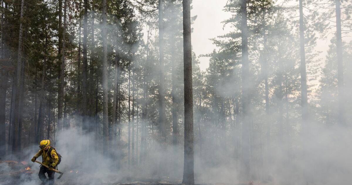
Firefighters made some progress Sunday against the massive Park Fire burning across Butte, Plumas, Shasta and Tehama counties — California’s largest wildfire of the year and the seventh-largest blaze on record in the state.
The 353,194-acre blaze was 12% contained due in large part to a brief pause in hot, dry weather conditions, according to the California Department of Forestry and Fire Protection. But crews face an uphill battle with higher temperatures and lower humidity on the horizon as the fire continues to burn in thick vegetation.
“We are at the mercy of weather, fuel and topography – those are the three determining factors of any fire,” said incident spokesman Jay Tracy.
The explosive wildfire ignited Wednesday afternoon after a man pushed a burning car into a ravine near Chico in what authorities say was an act of arson. Thousands of people have been evacuated from their homes, and at least 66 structures have been destroyed and 4,200 remain threatened.
Flames rage as the Park Fire jumps Highway 36 near Paynes Creek in Tehama County on Friday.
(Noah Berger/Associated Press)
Nearly 4,000 firefighters are battling the blaze from the air and on the ground, Tracy said. But the fire is burning in steep, rugged terrain that is difficult to access, including areas like the Ishi Desert that have not burned in decades and are therefore covered in vegetation and prone to fire, Tracy said.
“There is no infrastructure there that has the roads and access points that we need,” he added.
The fire is largely spreading northward, where communities like Paynes Creek remain a primary concern. Fortunately, many of the homes and neighborhoods in the area are spread out and not densely populated, which has so far allowed crews to keep property damage and other costs relatively minimal, Tracy said.
Another community of concern, Cohasset, on the southern perimeter of the fire, has also been spared so far due to a combination of “luck and hard work,” according to Zeke Lunder, a fire specialist and geographer based in Chico.
Satellite images of the fire captured by the European Space Agency show many active hot spots and flames, but also some beneficial forest management and fuel reduction projects that have helped keep some areas protected, Lunder said at a briefing Saturday night.
However, meteorologists say that fortunes could soon change. While a low-pressure system brought significantly cooler and wetter conditions to the region over the weekend, the next few days are likely to bring a gradual increase in temperatures and a decrease in humidity, according to Sara Purdue, a meteorologist with the National Weather Service in Sacramento.
“We’re looking at the possibility of temperatures reaching triple digits by next weekend,” Purdue said. “There’s still some uncertainty in the forecast, but it will be a slow transition to warmer than normal temperatures.”
The fire prompted a state of emergency declaration by Gov. Gavin Newsom, who said Saturday he had secured additional federal assistance to help fight the blaze.
“This is already one of the largest fires in California history and we continue to see dangerous conditions. Our firefighters and emergency crews are working around the clock to protect our communities,” Newsom said in a statement. “Californians should heed warnings from local authorities and take steps to stay safe.”
In fact, the Park Fire is far from the only fire burning in California, where crews are battling more than two dozen active wildfires.
In Kern County, the Borel Fire has burned more than 38,000 acres and was not 100% contained as of Sunday, according to Capt. Andrew Freeborn of the Kern County Fire Department.
The fire started Wednesday in the Kern River Canyon and spread rapidly as it moved through the canyon and encountered strong winds along the ridges, he said.
“We’ve been under red alert conditions and the fire continues to burn in a very, very intense and erratic manner,” Freeborn said. “The flames can be seen for miles. If you’re looking at how you would define extreme fire behavior, you’re seeing that with this fire.”
Evacuation orders and warnings have been issued throughout the area. Freeborn said structural damage is still being assessed; however, reports indicate there may have been significant structural losses in the town of Havilah.
The Borel Fire is being monitored along with two other fires in Kern and Tulare counties, collectively referred to as the SQF Lightning incident. The other fires are the Trout Fire, which has burned 22,660 acres and is 25% contained, and the Long Fire, which has burned 9,204 acres and is 35% contained.

An animal runs through the grass as it flees flames as the Park Fire rages through the community of Cohasset in Butte County on Thursday.
(Noah Berger/Associated Press)
Tracy, a Park Fire spokesman, said some of the extreme behavior displayed in the early hours of the fire appears to have subsided, such as tornado-like “fire whirls,” sometimes referred to as “firenados.”
But it is still spewing significant amounts of smoke, and federal smoke maps show plumes reaching as far as Oregon and Nevada.
The park fire has closed several roads and Lassen Volcanic National Park. Evacuation shelters are available at Neighborhood Church in Chico and Los Molinos Vet's Hall in Los Molinos. There are also shelters for large and small animals in Oroville, Red Bluff and Corning.
The race between weather and fires will continue on Sunday and in the days ahead, Tracy said.
“If the weather continues to cooperate, then we can continue this direct attack and begin to tighten containment,” he said.