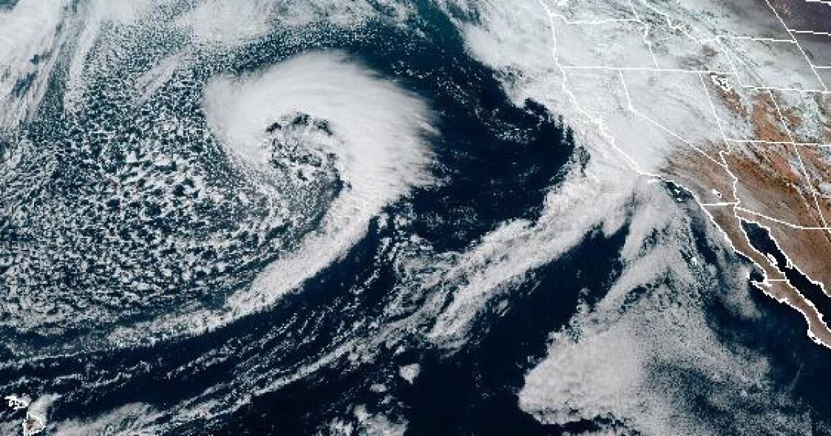
As gray skies loomed over most of Southern California on Saturday, the National Weather Service issued its predictions for the latest storm system to affect the Central Coast and Southern California through Wednesday.
Light rain is expected to fall in Los Angeles County on Saturday night, becoming moderate rain on Sunday afternoon and evening and continuing with heavy rain through Wednesday. Orange County and the Inland Empire will begin to feel the effect of the storm on Monday.
Compared to the system that brought record rainfall to the Los Angeles region on Feb. 4, “we're seeing quite a bit less,” said National Weather Service meteorologist Dave Gomberg. However, he added, “from Ventura County northward, those numbers could be quite similar.”
While forecasters have been tracking this system for the past few days, they are unsure where the worst of the storm will hit. The engine driving the system across the central Pacific is the jet stream (high-altitude winds over 200 mph) which is expected to decrease as it approaches the coast, creating uncertainty in the forecast so far. .
We are on track to reach “2 to 5 inches worldwide,” Gomberg said, “with 4 to 8 inches in the mountains and foothills. [and] with isolated totals of up to 10 inches in the Santa Lucia and Santa Ynez ranges.”
While the amount of rain may be less than the previous storm, he added, the system will bring heavier rain, falling at a rate of half to 1 inch per hour.
The news is especially worrying given the drenching Southland has received this month. With saturated soils, the chances of flooding, landslides and mudflows increase.
“It won't take much rain to cause major problems over the next few days,” Gomberg said, citing in particular the Santa Monica Mountains and Hollywood Hills.
Statewide, a flood watch advisory was issued for a wide swath of the coast from Big Sur to the Palos Verdes Peninsula and inland to the eastern San Gabriel Mountains.
High surf, with waves up to 20 feet, is also expected along the central coast with a swell of 8 to 15 feet south of Point Conception, affecting southwest-facing beaches on Tuesday.
Gomberg predicted “stronger wind” in Santa Barbara and San Luis Obispo counties with gusts between 20 and 40 mph and “locally damaging winds” in Los Angeles County.
“And again, it won't take much wind in this event because of the saturated soils… to see quite a few downed trees,” Gomberg said.
Initially, the storm will bring 1 to 3 feet of snow at elevations above 7,500 feet. By Tuesday, as temperatures drop, so will snow levels, bringing 1 to 4 inches to 6,500 feet.
A winter storm warning has already been issued for the southern Sierra Nevada.
Once the system has passed, the state will have a few days to recover before the arrival of another possible system next weekend, Gomberg said, this time coming from the north and potentially colder.