An unusually strong early-season cold front moved through Northern California on Friday, bringing with it the possibility of a rare August snowfall in the Sierra Nevada peaks.
A low pressure system moving in from the Pacific has created a few days of “weather whiplash” that forecasters say will dramatically lower temperatures and create conditions favorable for showers and thunderstorms on Friday and Saturday, before returning to more typical August weather patterns on Sunday.
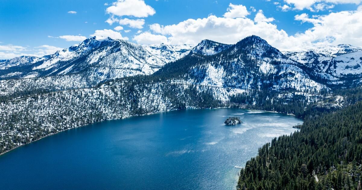
For the first time in more than two decades, August snow could fall on some of the highest peaks in California's Sierra Nevada, especially along Tioga Pass and the highest points in Yosemite National Park.
“It hasn't snowed [in August] “Snow has been falling here since 2003,” the National Weather Service in Hanford wrote in its Friday forecast. “While this snow will not remain for long, roads near Tioga Pass could be slick and campers and hikers should prepare for winter conditions.”
Forecasters said there was a 50 percent chance of a dusting of snow in the area early Saturday, with brief snow showers expected on peaks above 8,000 feet.
“Having something in late August is pretty early,” said Tony Fuentes, a meteorologist with the National Weather Service in Reno, though he said it’s not unheard of.
If something does fall, “it doesn’t seem like there’s much accumulation,” he said.
Still, some Tahoe-area ski resorts will be watching for snow Saturday morning, including Palisades Tahoe.
“It is exceptionally rare for our area to see new snowfall in August as it is typically one of the warmest months here in Tahoe,” resort spokesman Patrick Lacey said in a statement. The resort said it has not seen snowfall in August since 2004.
The change in weather that brings the possibility of snow will mostly give people an early “hint” of fall, including the possibility of record-breaking cold temperatures in the area, Fuentes said.
“The last time we had a cold front that brought us these temperatures in August was in 2014,” he said.
The Tahoe area will see some of the most dramatic drops, with highs on Friday and Saturday between 15 and 20 degrees below seasonal averages. Tahoe City is forecast to tie the record for coldest high temperature for the date (58 degrees), while South Lake Tahoe's forecast high temperature of 62 degrees is 5 degrees below the previous record.
Abnormally cold temperatures will be felt across Northern California, but the possibility of showers and thunderstorms is of greatest concern.
In the area burned by the massive Park Fire, which spans much of Butte, Tehama, Plumas and Shasta counties, authorities have issued a flash flood watch for Friday and Saturday. The fire has burned nearly 430,000 acres and was 65% contained as of Friday.
“Moderate to heavy rainfall could lead to flash flooding in low-lying areas and debris flows around the Park Fire burn area,” the alert said, adding that residents should prepare for possible flooding.
According to the National Weather Service, up to a half-inch of rain is possible in a few hours from Friday night into Saturday morning, particularly in Shasta County and the Redding area.
If thunderstorms develop, officials said the systems could create small hail, lightning and gusty winds, primarily in the northern Sacramento Valley.
The storm system will bring gusty winds across the state, which could increase the potential for wildfires. Kern County, in particular, is expected to be at elevated risk for wildfires through Saturday.
The turnaround from these below-average temperatures will be just as rapid, with seasonal highs expected to return on Sunday and Monday. Long-range forecasts even indicate that above-average temperatures are expected to return for the rest of the month.