After days of historic rain caused by a deadly atmospheric river storm, forecasters say dry weather is finally on the horizon for Southern California, but not until a smaller system brings more rain and snow to the region.
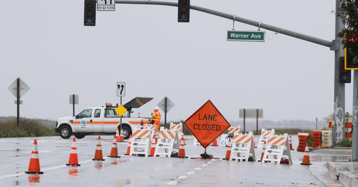
A new low pressure system is moving into the area on Wednesday, bringing a cold front and more precipitation, although nothing as severe as the main system that dumped more than a foot of rain on some parts of Los Angeles County since Sunday , causing landslides. flooding, widespread power outages and forced evacuations.
The statewide death toll from the storm rose to nine, including four people struck by trees in Northern California and three motorists who died after crashes in central and southern California, according to state officials.
In the Los Angeles area, the next storm could bring another half-inch of rain Wednesday night in the metropolitan area and up to an inch in the foothills and mountains, said Mike Wofford, a meteorologist with the National Weather Service in Oxnard.
“A storm like this, if we hadn't had so much rain before, it wouldn't be a big deal,” Wofford said. But with the ground still saturated and many slopes still precarious due to debris flows and landslides, “there could be some additional problems because of that.”
He said most of the area should be able to withstand the additional rainfall, but said residents in neighborhoods that have already experienced slides, especially in the Santa Monica Mountains, should remain cautious. Rainfall totals exceeded 13 inches in some places there and in the San Gabriel Mountains, including Bel-Air, Topanga and Cogswell Dam north of Monrovia.
More widespread rain will continue to move inland into San Diego County early this morning with brief, heavy showers. Hourly rainfall will be mostly one-tenth to one-third of an inch locally. #cawx pic.twitter.com/rm7eg8inII
– NWS San Diego (@NWSSanDiego) February 7, 2024
Evacuation warnings are still in effect near several burn areas in the northern San Gabriel Mountains and parts of Culver City.
The southern and eastern regions of Los Angeles County could see heavier rain from this next storm, which is forecast to reach San Diego and the San Bernardino Mountains later Wednesday and remain through Friday. .
“We have some precipitation through Friday, but we're hoping by Saturday we'll dry out a little bit,” said John Suk, a meteorologist with the National Weather Service in San Diego. “I think this weekend will be the first real break we'll see.”
A flood watch remains in effect through Wednesday night for much of southwestern California, including Orange, San Bernardino and San Diego counties, with up to an inch or two of additional rain expected.
“This additional rainfall falling on saturated ground will increase the potential for flooding,” the alert said.
The San Diego River at the Fashion Valley shopping center and downstream of Prado Reservoir in Chino and West Corona, had heightened flood watches on Wednesday, warning of minor flooding, especially in low-lying areas.
A low pressure system will affect central California today through Thursday morning, causing periods of precipitation. The snow level will drop to about 3,000 feet tonight. Snow accumulation is likely over Tejon Pass and Tehachapi Pass tonight and Thursday morning. #CAwx pic.twitter.com/CZhwL4F8Vp
– NWS Hanford (@NWSHanford) February 7, 2024
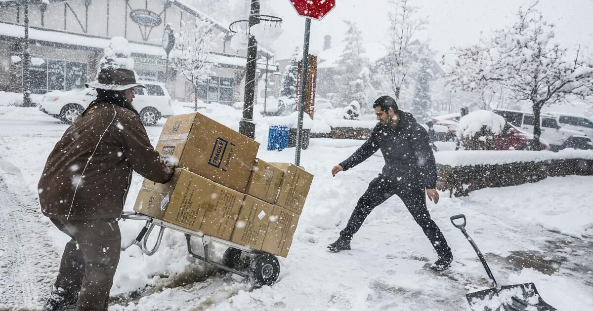
He next coldest storm It is expected to be more snow-focused, with up to 2 feet of snow falling Wednesday through Thursday in the Sierra and Southern California mountains.
A winter storm warning remains in effect through Thursday morning for the Los Angeles, Riverside, San Bernardino and San Diego mountains, with elevations as low as 4,000 feet expected to receive up to 6 inches of snow.
“This is a colder storm,” Wofford said, “so snow levels are lower.”
By late Tuesday, Mountain High had already received 30 inches of snow from the latest storm; Mount Baldy was 2 feet, Snow Valley was 18 inches and Wrightwood was 10 inches, Suk said. Mountain High, one of the highest peaks, had reached 51 inches as of Wednesday morning, Wofford said, and accumulation had been recorded as low as 4,500 feet.
Wofford said there could be some issues for travelers on the Grapevine on Thursday and Friday.