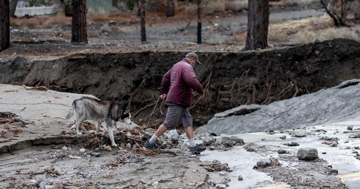
The most intense part of a storm system that hit the Los Angeles area and other parts of the South eased somewhat by Christmas morning, but rain is expected throughout the day, at times locally heavy, with continued risk of landslides in recently burned areas, including those of the Palisades and Eaton fires.
The forecast and heavy rain led Los Angeles Mayor Karen Bass to issue an emergency declaration.
Overall, the chance of rain in Los Angeles County is 50% during the day on Thursday and 80% overnight, according to the National Weather Service.
The rain also caused a sewage spill of about 10,000 gallons, county officials said, which has created dangerous conditions three-quarters of a mile upstream and downstream of Cabrillo Beach in San Pedro, where visitors are advised to avoid contact with water and wet sand. The county Department of Public Health is conducting water sampling and the closure will continue until bacterial levels meet health standards.
During the day in Los Angeles County, forecasters project between a tenth and a quarter of an inch of new rain, although local storm activity will bring more rain than that in some areas.
Rainfall is expected to increase overnight, with projections of between a half and three-quarters of an inch of precipitation.
The weather service also issued a flash flood warning for southwest Los Angeles County for Thursday.
“At 8:53 am Doppler radar indicated storms producing heavy rain in the alert area,” an alert warned. “Flash flooding is ongoing or expected to begin shortly.” The alert warned of “flash flooding of small streams and streams, urban areas, roads, streets and underpasses, as well as other low-lying and poorly drained areas.”
Areas expected to experience flooding include “Eastern Malibu, Topanga State Park, Pacific Palisades, Topanga Canyon Road through the Santa Monica Mountains, Malibu Canyon and Los Virgenes Roads through the Santa Monica Mountains and Mandeville Canyon.”
On Thursday morning, there were severe thunderstorms across southern Ventura County and radar was tracking storm activity along a line extending from 6 miles south of La Conchita to near Point Mugu. According to the weather service, wind gusts reached up to 50 miles per hour: “Although not immediately likely, Doppler radar has indicated weak rotation with this activity, and a brief, weak tornado cannot be ruled out.”
As of Wednesday, the storm system dumped 2 to 4 inches of rain across the region, with some areas receiving 4 to 8 inches and 10 inches in the foothills and mountains.
By early Wednesday afternoon, the Los Angeles Fire Department had deployed crews to three river rescue incidents. No additional information was immediately available.
Meanwhile, the Los Angeles Police Department had responded to more than 100 traffic accidents. No traffic-related injuries or deaths have been reported. The city's transportation department was working to restore five traffic signals and city crews were responding to “nearly 500 tree emergencies.”
Statewide, a winter storm warning remains in effect for the Sierra Nevada above 7,000 feet above sea level from Yosemite to the Lake Isabella area through Friday, with 12 inches of snow per day expected. By the weekend, snow is possible in areas as low as 5,000 feet above sea level.
The cities of Tehachapi, Frazier Park, Lebec and Grapevine were under a high wind warning until 4 p.m. Friday, with southerly winds of 15 to 25 mph with gusts up to 45 mph, conditions that will likely affect drivers heading north or south on the main route through the Grapevine Mountain Pass.
“Damaging winds will down trees and power lines,” the National Weather Service said. “Widespread power outages are expected. Travel will be difficult, especially for high-profile vehicles.”
The NWS warned that those living in the hardest-hit areas should “stay on the lower levels of your home during the windstorm and avoid windows. Watch for falling debris and tree branches. Use caution if you must drive.”
Mayor Bass said in a statement: “We are making every resource and tool available to help facilitate the city's ongoing response effort…I urge all Angelenos to stay safe and be extremely careful on the roads if travel is absolutely necessary. Please do not take this storm lightly – follow official guidelines, plan ahead, and sign up for emergency alerts at NotifyLA.org.”
Rain is expected to ease late Friday night and dry, warm weather is expected to return by the middle of next week.