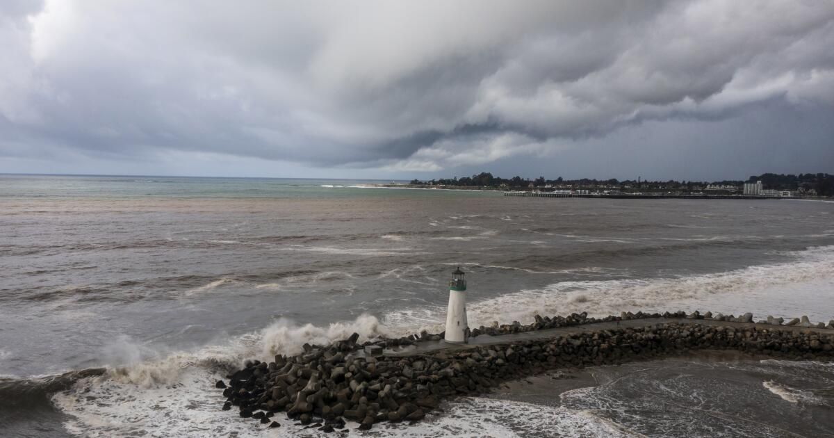
Southern California is bracing for the largest storm of the season, which is scheduled to bring potentially damaging and life-threatening rain, winds and flooding to the region.
But the powerful atmospheric river (which is worrying enough on its own) is being overloaded by climate change and El Niño, which together are warming ocean waters, increasing the chances of major rainfall and offering a preview of the state's future. in a warming world, experts say. .
The incoming storm is feeding on unusually warm waters between California and Hawaii, where a major marine heat wave has persisted for months, said Daniel Swain, a climate scientist at UCLA.
Last year, the hottest year on record on the planet, the global heat content of the oceans soared to a record level.
“As ocean temperatures warm and atmospheric temperatures warm, those evaporation rates of water vapor into the lower atmosphere will increase quite rapidly,” Swain said during a briefing on Friday. “An increase of a few degrees in water temperature near the coast and offshore means there is more moisture in that lower atmosphere.”
In other words, additional heat and moisture from the warm sea surface is wetting atmospheric river storms as they approach California, making them more likely to bring heavy rain.
The warming of ocean waters is due in part to El Niño, a weather pattern in the tropical Pacific associated with warm, humid conditions in Southern California, Swain said. But climate change is also raising sea temperatures.
“It's a combination of El Niño and global warming that's why the oceans are so warm over such a wide region,” Swain said. “It is not 100% clear exactly to what extent each is a relevant actor, but both are important. The long-term trend, of course, is mainly due to climate change and the warming of the oceans associated with it.”
The warm waters are part of the reason California has seen so many storms marked by heavy downpours this season.
In December, a storm that hit Oxnard produced a month's worth of rain in less than an hour.
Last month, a similar historic event drenched San Diego with more rain in a few hours than the area typically sees in all of January.
In the wake of those storms, experts said warm ocean waters were likely a contributing factor. Both were called “thousand-year events,” or events with a probability of 0.1% in a given year.
However, the same pattern has already reappeared, although to a lesser degree, when another atmospheric river flowed on Thursday, Swain said. Parts of downtown San Francisco saw more than an inch of rain in an hour, while Long Beach also experienced significant flash flooding.
“We've seen this happen at least four times this year in California: in San Francisco, Ventura, Long Beach and San Diego,” Swain said, noting that in each incident, warm ocean temperatures were an important ingredient.
“I think it really tells us something about what future California winters will increasingly look like in a warmer climate,” he said.
The incoming system could bring similar conditions this weekend to a wide swath of the South, including the Los Angeles area, where officials are bracing for up to 6 inches of rain and associated flooding, debris flows and damaging winds.
Precipitation is likely to be half an inch per hour for several hours as the storm moves south from Santa Barbara County to Los Angeles on Sunday night, with local rates of 1 inch per hour possible, according to the National Meteorological Service.
Los Angeles County officials said they are closely monitoring the Palos Verdes Peninsula, which suffered a devastating landslide last summer and a landslide on Thursday, as well as the mountains and foothills of Saint Gabriel.
“We're always keeping an eye on that area, especially with recent burn scars like in Duarte, with the Fish Fire,” said Emily Montanez, associate director of the Los Angeles County Office of Emergency Management. “In areas with burn scars, within three years after the fire, there is always the possibility of mud and debris flowing.”
The county public works department is clearing storm drains and flood control channels in preparation for an influx of water, he said. The agency is expected to issue graduated warnings for areas in the storm's path, which may include possible evacuation advisories in Duarte, Azusa, the Santa Clarita Valley and other at-risk areas.
“This will probably be categorized as our biggest storm this winter so far,” Montanez said.
Although the forecast is changing rapidly as the storm approaches, the weather service said it could drop up to 6 inches of rain along the coast and 12 inches in mountainous areas of Los Angeles County, and much of She will fall in a 24- to 36-hour period from Sunday to Monday.
“Historically, rainfall of this magnitude creates significant hydrological problems in our area, and there is no reason to think this will not happen with this event,” the agency said. “People should start preparing now for a major flood.”