Cooler temperatures and possible rain are coming to Southern California this weekend, but with heightened fire risk in a region already burning the state's largest wildfire this year.
The National Weather Service is forecasting scattered showers and thunderstorms across the southern half of the state on Saturday, along with some cooler temperatures over the weekend that could finally bring temporary relief from a prolonged heat wave scorching the region.
National Weather Service meteorologist John Dumas said that despite the potential for wet weather and cooler temperatures, the fire risk can only increase.
In a pattern known as virga, moisture in the middle layers of the atmosphere will fall as rain but evaporate before reaching the ground, Dumas said.
“Unfortunately, lightning can still strike,” Dumas said, potentially sparking new wildfires.
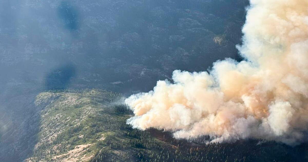
That could worsen conditions for fire crews working around the clock to extinguish the Lake Fire in Santa Barbara County, California’s largest so far this year. That blaze has grown to 37,742 acres, but firefighters have worked to contain it around the Santa Ynez and Los Olivos region, where structures were threatened.
Crew members have made a “visible difference” on the south side of the fire in recent days, where flames previously could be seen from Santa Ynez and the Cachuma Lake area, said Capt. Scott Safechuck, a spokesman for the Santa Barbara County Fire Department.
Firefighters have worked through the night to make some progress on the fire with controlled burns of dry vegetation and a helicopter dropping water. Those coordinated efforts “have been really successful in eliminating a lot of the threat on the south side,” Safechuck said.
The risk of dry lightning sparking fires has prompted weather officials to issue a red flag warning until 9 p.m. Saturday for the mountain and foothill regions of Los Angeles County, according to the weather service, along with the Antelope Valley and valleys in San Luis Obispo and Santa Barbara counties, Ojai and Casitas Valley.
Dumas said weather service officials have tools that can track and model potential lightning strikes in real time, helping firefighters on the ground.
Dumas also said the heat will ease by a degree or two over the next few days, leading to “near-normal temperatures” by Monday or Tuesday, before a new heat wave is expected to sweep through Southern California.