A series of late winter storms have filled reservoirs, increased snowpack and left forecasters anticipating a late start to California's wildfire season.
And while the odds also lean toward a milder-than-normal fire season overall, that outlook could change in July, said National Interagency Fire Center meteorologist Jonathan O'Brien.
“It's too early to say at this point what the peak months will be like,” said O'Brien, who works for NIFC Predictive Services in Riverside.
For now, Predictive Services is forecasting below-normal large fire activity in Southern California in May and June, and normal activity in Northern California.
The rainy season has already been wetter than normal in Southern California, and forecasts call for periods of rain and snow well into April, if not early May, O'Brien said. Vegetation at lower elevations is moist and green; in the highlands, it is buried in snow.
Statewide, snowpack most recently measured 104% of normal for March 5 and 95% of average for April 1, when it is typically deepest.
The more moisture there is in the snow cover, the longer it will take to melt. That ensures that vegetation dries out more slowly and also helps moderate the onset of warmer weather, said Brett Lutz, a BLM meteorologist with Predictive Services Northern California Operations.
“Years where we've had above-average snowpack have been correlated, especially in Northern California, with an overall trend of below-average burned area,” Lutz said.
Still, as climate change pushes California fires to burn at higher elevations — places that were once too wet or cold to feed the flames — more snow is falling in burned areas, said Amir AghaKouchak, a professor of civil and environmental engineering at UC Irvine. Some of these places have small tree canopies to protect the snow from the sun, and that could cause the snowpack to melt more quickly, he said.
“Therefore, potentially, more and more fire-snow interactions may contribute to a stronger or more rapid shift from flood risk to drought risk,” he said.
Additionally, the snow line has been rising directly in response to warming that has taken place in recent decades, said Alexander Gershunov, a research meteorologist at the Scripps Institution of Oceanography.
“That makes montane ecosystems more flammable in the summer,” he said, noting that these fuel-dominated fires in forested areas have been responsible for much of the increase in wildfire activity in California over the past two decades.
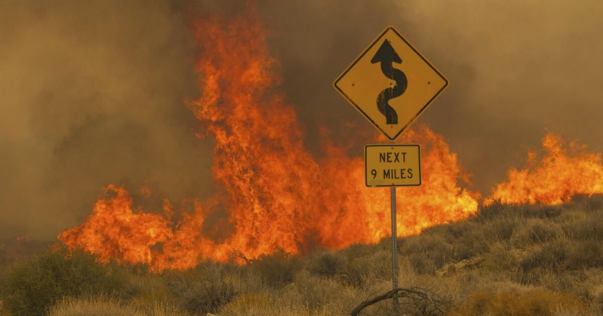
Additionally, meteorologists are closely watching the state's desert areas, many of which recorded above-normal rainfall this year and last, spurring the growth of grasses and small shrubs. Once the material cures, which tends to happen from late April through June, it could fuel fires like the York Fire, the 93,000-acre fire that swept through the Mojave National Reserve in July and was the state's largest fire on last year.
Northerly and offshore winds, generally known as Diablo winds in the north and Santa Anas winds in the south, have fueled some of the state's most damaging fires. Predictive Services forecasters expect near or below normal numbers of these wind events over the next three months.
Part of that has to do with El Niño, the warm phase of the El Niño-La Niña Southern Oscillation pattern, which is a major driver of temperature and precipitation patterns around the world.
The phenomenon typically results in the jet stream splitting into a subtropical and polar jet, rather than being a consolidated stream, said Brent Wachter, a meteorologist with Predictive Services Northern California Operations. “That kind of steals the energy needed to achieve as many of these stronger offshore wind events as possible,” he said.
While in Southern California, Santa Ana winds do not tend to fuel fire growth until late summer and fall, in Northern California, destructive fires that occur in May and June are typically linked to a wind event, Wachter said.
Still, California is in a different place than it was this time last year, when conditions were so wet that forecasters were confident the entire fire season would be relatively mild. They can't make that decision yet this year and warned that a lot could change between now and July, when peak fire season typically begins.
Some of the variables that can make or break a fire season are unpredictable. For example, in 2022, conditions were dry and warm, but the state benefited from some timely precipitation that moderated fire activity. In 2020, late summer dry lightning sparked dozens of fires, making a regular season the worst on record in the state.
“These wild cards can always arise,” said John Abatzoglou, a professor of climatology at UC Merced. “Things could change quickly, if the faucets in the sky closed very quickly, if we saw a really warm summer, if we saw an active series of dry lightning moving across the state.”
Perhaps the most monitored variable is heat, which absorbs moisture from the vegetation, preparing it to burn. Predictive Services forecasts below-normal temperatures for the South and near-below-normal temperatures for Northern California through June. But there is also some uncertainty in that.
Other forecasts, such as those from the National Weather Service's Climate Prediction Center, favor above-normal temperatures across Northern California and roughly equal chances of above- and below-normal temperatures for the southern part of the state.
This is because meteorologists believe we are moving away from El Niño and toward a likely La Niña (which denotes cooler than average sea surface temperatures across the Tropical Pacific) toward late summer or fall. The difference in temperature outlooks for the coming months is largely tied to how quickly that transition occurs, Wachter said. Predictive Services is betting on a more rapid change, which would likely result in colder conditions in the spring and early summer, while the Climate Prediction Center predicts the transition will take place more slowly.
“So that's the big question, and that's why temperature forecasting is a little bit more difficult right now,” Wachter said.
While researchers generally see good relationships between how hot and dry fire seasons are and how much area burns in the state's forests, in non-forested areas the picture is a little more mixed, Abatzoglou said.
Since vegetation is dry enough to spark fires most years, other factors come into play when determining the severity of the fire season. These include the amount of fine fuels (grasses, twigs, needles, and leaves) in the landscape.
“When we have a wet year where there is enough moisture to allow fuels to grow somewhat unchecked, similar to what we saw last year in much of the state, that increases the grass harvest,” he said. “And it may not burn that year, but the next year ends up being a pretty good year for fire.”
In fact, the most damaging fire seasons in Southern California tend to follow a rainy season in which precipitation was near normal, O'Brien said. Too much and the humidity slows the spread of large fires during the summer. Very few fine fuels do not grow large enough to be able to transport flames across the landscape.
When precipitation is enough to help grasses grow but moisture doesn't remain throughout the summer, a more active season typically results, O'Brien said.
“By the time you get to mid-to-late summer, everything has dried out and you're really primed for fire activity with a lot of dead fuel at play,” he said.
For example, record rainfall in the early months of 2017 boosted vegetation growth, but by that summer (the hottest on record in California at the time) much of it had dried out. Three of the 20 most destructive wildfires in state history burned between October and December of that year, including the Thomas Fire.
If the state gets another reprieve from serious fire activity this year, it is not expected to last.
Wildfires in California burned five times more area between 1996 and 2020 than between 1971 and 1995, and almost all of that increase can be attributed to human-caused climate change, according to research by Abatzoglou and AghaKouchak published in the Proceedings of the National Academy. of Science last year.
That long-term trend is expected to persist, resulting in an increase of up to 50% in the area burned between 2031 and 2050, according to the study.
“Within this long-term change, there can be high anomalies, low anomalies, a lot of variability,” AghaKouchak said. “Climate change does not mean that temperatures will become warmer every year. But overall, if you look at the overall trend and pattern, we are seeing rising temperatures and increased risk of drought and fire.”