Severe thunderstorms are likely beyond Monday as the peak of the severe weather season progresses. More damaging storms are likely through at least Thursday in the central and eastern United States.
Some severe thunderstorms from Monday night are likely to persist into Tuesday morning and could affect parts of the Midwest. Damaging wind gusts are the main threat with thunderstorms lingering Tuesday morning, but hail and an isolated tornado cannot be ruled out.
The storms are expected to dissipate in the afternoon, but more severe storms are likely in their wake.
Parts of the Midwest and Tennessee Valley are under a Level 2 of 5 risk for severe thunderstorms on Tuesday, including Indianapolis, Cincinnati and Nashville.
Afternoon and overnight storms could unleash damaging wind gusts, baseball-sized hail, and tornadoes.
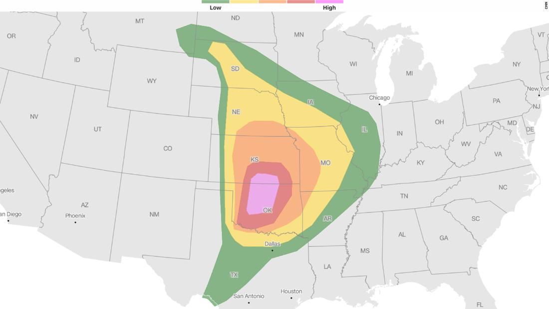
A much more expansive threat is emerging for Wednesday. More than 48 million people are at a level 2 risk of 5 or higher for severe thunderstorms on Wednesday.
Severe thunderstorms could come to life late Wednesday morning across the southern Plains and Mississippi Valley. Storms will increase in range and strength as they move east through the afternoon and evening, eventually reaching the Appalachians Wednesday night.
Hail, damaging winds and tornadoes are the main threats of any storm. Some tornadoes could become strong (at least EF2 strength), especially from extreme northeast Texas to extreme southwest Ohio.
An additional round of severe storms could develop east from Georgia to New Jersey on Thursday afternoon. A separate area of strong storms is possible in Texas. Any storms on Thursday could produce damaging wind gusts and hail.