Tropical Storm Francine will likely strengthen into a Category 1 hurricane before reaching the Louisiana coast on Wednesday.
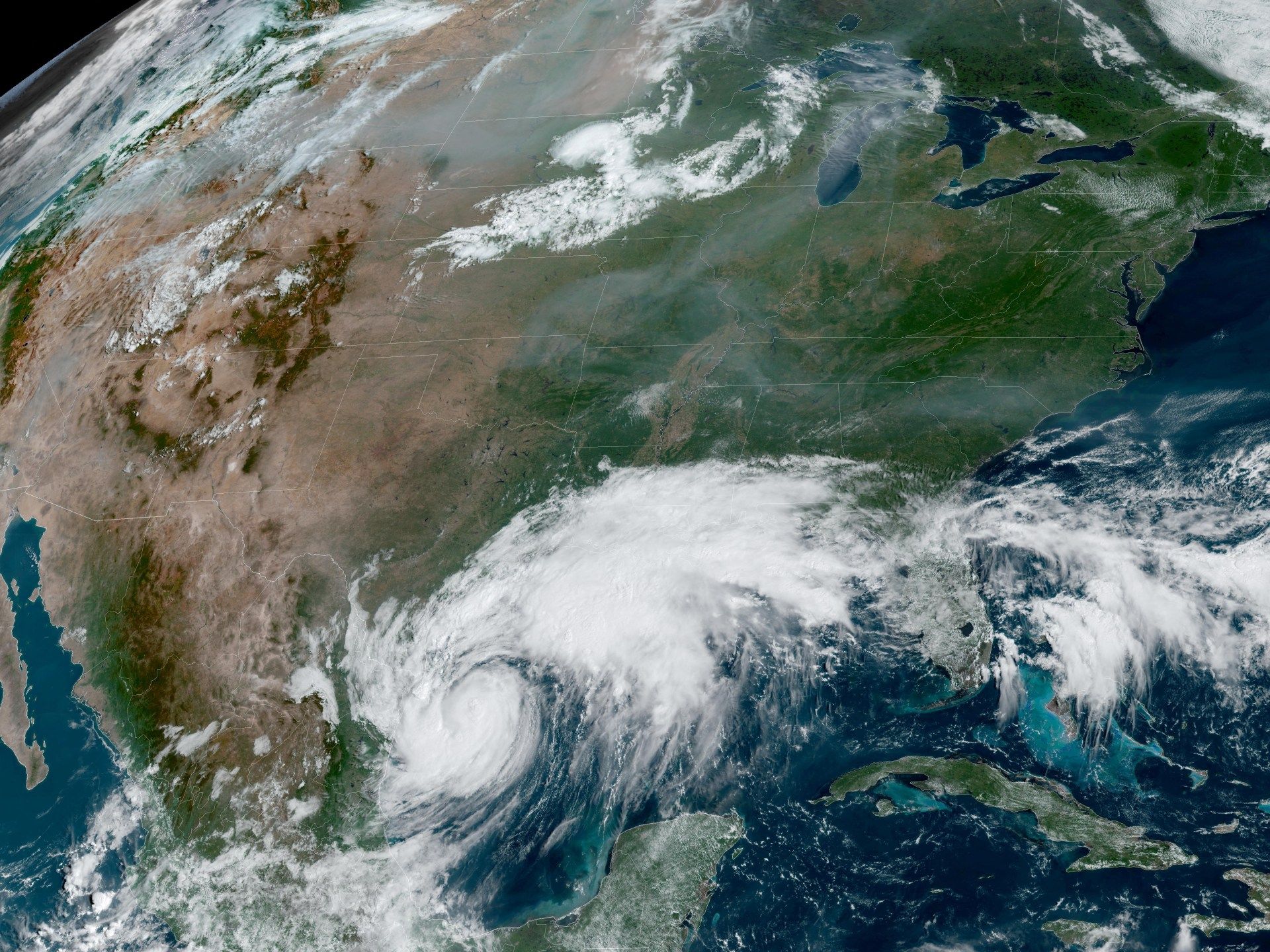
A tropical storm moving over the Gulf of Mexico is expected to strengthen into a hurricane, threatening the southern United States, including the coasts of Texas and Louisiana, the National Hurricane Center (NHC) said.
Tropical Storm Francine is expected to travel over warm waters that will fuel its strengthening before making landfall as a Category 1 hurricane on Wednesday with winds of 90 mph (145 km/h).
The storm is expected to remain near the northeastern coast of Mexico on Tuesday as it moves northeast toward the United States.
Forecasters warned coastal residents of possible storm surges of up to 10 feet (3 meters) in some places, as well as possible tornadoes and dangerous winds. Residents were encouraged to evacuate some low-lying areas.
As of Tuesday afternoon, Tropical Storm Francine was located about 380 miles (610 km) southwest of Morgan City, Louisiana, and about 85 miles (136 km) west of New Orleans. With maximum sustained winds of 65 mph (105 km/h), it is 9 mph (14.5 km/h) shy of hurricane strength.
Tropical Storm Update for September 10th at 7am CDT #Francina.
Coastal hurricane warnings have been extended eastward to Grand Isle, Louisiana. A tropical storm warning is now in effect as far as the mouth of the Pearl River, including the New Orleans metropolitan area.
Last update: photo.twitter.com/JCoUgQ3U3o
— National Hurricane Center (@NHC_Atlantic) September 10, 2024
Schools closed
Louisiana Gov. Jeff Landry urged residents “not to panic, but to be prepared” and heed evacuation warnings. Some schools and colleges in the state closed Tuesday and Wednesday as a precaution.
In Baton Rouge, Louisiana's capital, long lines began to form as people filled their gas tanks and stocked up on food.
Louisiana’s coast is still reeling from the battering of Hurricanes Laura and Delta in 2020, followed a year later by Hurricane Ida. The state recently marked the 19th anniversary of Hurricane Katrina, a major Category 5 storm that caused 1,392 deaths and an estimated $200 billion in damage.
U.S. oil and gas producers in the Gulf of Mexico, including Exxon Mobil and Shell, had evacuated staff and in some cases halted drilling in preparation for the storm.
Warmer seas
Francine is the sixth named storm of 2024. Its arrival comes at a time when meteorologists have been scratching their heads over a quiet August and early September, typically the peak of the annual hurricane season, which typically lasts from June through November.
Experts had predicted a busier-than-usual season this year due to a confluence of factors, including warmer-than-usual seas.
The water temperature is about 87 degrees Fahrenheit (31 degrees Celsius) where Francine is located, said Brian McNoldy, a senior research associate at the University of Miami's Rosenstiel School of Marine, Atmospheric and Earth Sciences.
“The ocean heat content averaged across the Gulf is the highest on record,” McNoldy wrote on his blog.
Forecasters are also monitoring two other weather systems in the mid-Atlantic that have the potential to develop into larger storms.