Following grim forecasts of an above-normal hurricane season, conditions in the Atlantic have become eerily calm in recent weeks.
The last time the Atlantic didn't produce any named storms between Aug. 13 and Sept. 3 was in 1968, more than 50 years ago, according to a new report from researchers at Colorado State University. This was also the first Labor Day holiday weekend without a named storm in 27 years.
“This pronounced [quiet] “This period is particularly notable given that it coincides with the time of year when the Atlantic is climatologically very busy,” the report says.
The lull comes after federal officials warned of an 85 percent chance of above-normal hurricane activity in the Atlantic, with as many as 25 named storms this year. So far, there have been five named storms, three of which became destructive hurricanes: Beryl, Debby and Ernesto.
Aggressive and shocking reports on climate change, the environment, health and science.
But experts say it is too early to call the season over and warn that storm activity will likely increase in the coming weeks. The Atlantic hurricane season runs from June 1 to Nov. 30.
“We’re a little behind where we should be, with five named storms to date,” said Dan Harnos, a meteorologist at the National Oceanic and Atmospheric Administration’s Climate Prediction Center. But “the typical peak of the season doesn’t occur until Sept. 10, and historically there’s more hurricane activity after the peak than before it.”
In fact, it's more common for the second half of the season to see much more activity than the first, with August, September and October accounting for 90% of seasonal activity, according to the National Hurricane Center. In 2022, eight hurricanes occurred after Sept. 1.
Still, the reasons for the recent calm are somewhat puzzling.
David Zierden, a Florida state climatologist, said there are numerous factors that could be at play, including the delayed onset of La Niña, shifting monsoon patterns in West Africa and Saharan dust activity.
La Niña, a climate pattern in the tropical Pacific that helps determine weather patterns around the world, was a major factor in the early-season outlook. That's because it tends to reduce wind shear in the tropics, allowing hurricanes to gain strength, and it keeps Atlantic Ocean water warm, which helps fuel storms.
But La Niña has taken longer to develop than initially anticipated and is now not expected to appear until later this fall.

A woman rows a boat down a Baltimore street after Hurricane Debby in early August.
(Kaitlin Newman/Baltimore Banner via Associated Press)
“There’s still a 60% to 70% chance that it will develop and remain that way for the remainder of our hurricane season, so it still seems to be a factor that would indicate a more active season, along with near-record and record high sea surface and ocean heat content,” said Zierden, who is also a research associate at Florida State University.
And while the rainy season in West Africa has been active this year, it has shifted farther north than normal for reasons that are still not entirely clear, Zierden said. Because of this, disturbances coming from Africa are bringing drier air and sea surface temperatures less favorable for hurricane formation. As a result, storms “are not really developing as they would if they were coming from that more southern track.”
Saharan dust is also a mitigating factor, making the atmosphere drier, more stable and less prone to hurricane formation. Dust is usually a major factor early in the season, but this year its activity continued well into August, which may have contributed to the calm.
But there are other factors that could still cause problems, such as warm ocean temperatures across much of the Atlantic basin, which can provide more energy to fuel storm development. Sea surface temperatures in 2023 far exceeded those of any previous year on record, and this year has been equally warm and in some cases even surpassed them.
“It's part of a general trend of warming oceans and sea surface temperatures, and that can be attributed to climate change and anthropogenic warming,” Zierden said.
Still, warm waters don't necessarily mean that all the ingredients that go into tropical cyclone formation will be favorable in a warming climate, he said, meaning the total number of tropical cyclones worldwide may not change much.
However, the potential for stronger storms is increasing, as evidenced by Beryl, which became the earliest Category 5 hurricane on record in the Atlantic when it formed in late June.
The storm hit parts of the Caribbean and the Gulf Coast and was associated with At least 36 dead in Texas, where it flooded roads and left more than 2.5 million people without electricity.
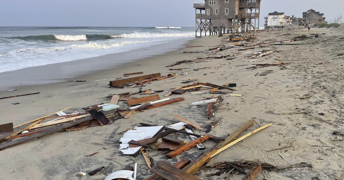
Hurricane Debby struck the west coast of Florida in early August, also bringing high winds and widespread flooding. The most recent storm, Ernesto, formed on August 12 and continued into Hitting Puerto Rico and Bermuda.
For that reason, Zierden said, “we should neither let our guard down nor breathe a sigh of relief.”
“My main concern is not that we will reach the projected number of storms, but that of those that do form, one or more have the potential, with these very warm sea surface temperatures in the Gulf of Mexico and the Caribbean, to be very strong, damaging and even deadly storms,” he said. “That is still on the table as we enter the peak of the Atlantic hurricane season.”
He is not the only one who said the season might not deliver the expected number of storms.
The recent lull in activity prompted AccuWeather, a private weather forecasting website, to lower its seasonal outlook to 16 to 20 named storms; six to 10 hurricanes; three to six major hurricanes; and four to six direct hits in the United States.
“Our team has been integrating the latest data and insights while monitoring the unusual conditions that have hampered tropical storm and hurricane development over the past month,” AccuWeather Chief Meteorologist Jon Porter said in a statement about the downgrade.

A man in Plainfield, Vermont, surveys damage caused by Hurricane Beryl in July.
(Charles Krupa/Associated Press)
However, Porter noted that the season has already been damaging, with preliminary estimates indicating up to $32 billion in economic losses in the United States from Hurricane Beryl and $28 billion from Hurricane Debby.
“We don’t want anyone to let their guard down even though we are now forecasting fewer storms overall,” Porter said, adding that ocean waters are still incredibly warm near many of the country’s coastal cities. “It only takes one powerful hurricane or slow-moving tropical storm to threaten lives and cause devastation.”
NOAA officials declined to comment on AccuWeather's updated forecast but said its Climate Prediction Center's Aug. 8 forecast will be its final release for the season.
The outlook showed minimal changes from the agency's first outlook issued in May, which called for up to 24 named storms, 13 hurricanes and seven major hurricanes.
The outlook for the Pacific basin, which last year experienced a rare storm surge in Hurricane Hilary, also remains unchanged, with a 60% chance of a below-normal season.
But although hurricane season officially ends on Nov. 30, there are signs that tropical storms could continue to form in the Atlantic through December, said Erica Grow Cei, a meteorologist and spokeswoman for the National Weather Service.
“This is due to the early onset of La Niña, which suppresses wind shear, and the persistent anomalous heat that is expected to remain in the tropical Atlantic and the Caribbean,” Grow Cei said.
Accumulated storm energy (NOAA's measure of overall activity) also remains well above normal thanks to contributions from Beryl, Debby, and Ernesto.
“Hurricane season started early and violently with Hurricane Beryl, the earliest Category 5 Atlantic hurricane on record,” NOAA Administrator Rick Spinrad said in the agency’s August update.
“NOAA’s update to the seasonal hurricane outlook is an important reminder that the peak of hurricane season is just around the corner,” he said, “when historically the most significant impacts from hurricanes and tropical storms tend to occur.”