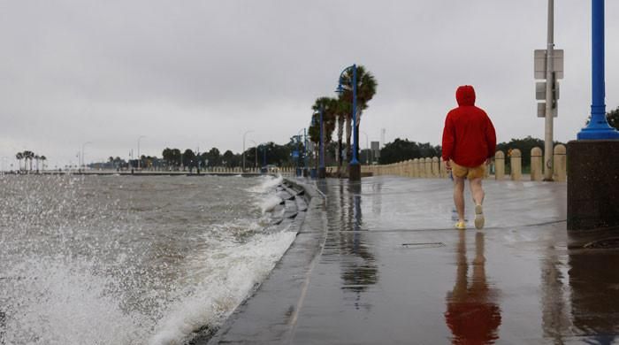
Hurricane Francine strengthened into a Category 2 storm Wednesday just before making landfall in Louisiana, threatening New Orleans and the broader Gulf Coast with high winds, rain and a storm surge that prompted evacuation orders for thousands of people.
Francine had maximum sustained winds of 100 mph (155 kph) when the storm's eye reached the southern Louisiana coast near Morgan City, Louisiana, about 90 miles (145 kph) southwest of New Orleans, the U.S. National Hurricane Center said.
The hurricane center upgraded the storm from a Category 1 to a Category 2 storm on the five-level Saffir-Simpson scale, which produces extremely dangerous winds that will cause significant damage. The storm's intensity was expected to change little before landfall later Wednesday.
The storm was moving northeast at 17 mph (28 km/h), putting not only Morgan City but also New Orleans in its general path. The New Orleans metropolitan area was under a hurricane watch, meaning hurricane conditions were possible.
“It's right on our doorstep. Once the storm passes, please stay put,” Louisiana Gov. Jeff Landry said at a news conference. “Stay off the road.”
Morgan City had already put a curfew in place until 6 a.m. Thursday, Police Chief Chad Adams told reporters.
“We want everyone to stay home,” Adams said of the city's 11,000 residents.
After making landfall, the hurricane was expected to move toward southeastern Louisiana on Wednesday night, the National Hurricane Center said.
Landry and U.S. President Joe Biden each declared states of emergency in anticipation of the storm, freeing up emergency management resources and possible financial aid in the event of severe damage.
Several parishes or counties on or near the Louisiana Gulf Coast issued mandatory evacuation orders, and the state Department of Transportation posted evacuation maps. The city of New Orleans distributed sandbags at five locations.
Bourbon Street in New Orleans’ famed French Quarter was eerily empty Wednesday afternoon as people heeded warnings to shelter in place. New Orleans had not experienced the winds and gusts expected when the hurricane’s eastern wall began making landfall near Morgan City.
Any major storm near Louisiana evokes memories of Hurricane Katrina, the 2005 storm that devastated New Orleans and surrounding areas, killing nearly 1,400 people and causing $125 billion in damage, according to a 2023 hurricane center report.
Water from Lake Pontchartrain, which borders the city to the north, was beginning to overflow the seawall. Since Hurricane Katrina, however, the federal government has built a $14.5 billion levee protection system, including stormwater gates that can prevent storm surges from entering the city's interior drainage channels, which suffered a catastrophic failure during Hurricane Katrina.
Grocery stores were closed by late afternoon, but not before veterans of previous storms stocked up on provisions.
“We're all set. We've got our canned goods and our groceries,” said Steve Rodriguez, who has lived in New Orleans since 1983 and was trying to do some last-minute shopping. “I was hoping to get some sausages. I have meat in the freezer, but it would be easier to cook beans or something.”
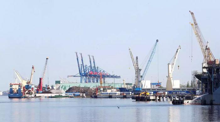
The storm has already had the effect of disrupting energy production and agricultural exports from the US Gulf of Mexico.
According to the offshore platform regulator, almost 39% of oil production and almost half of natural gas production in the US Gulf of Mexico was suspended on Wednesday. In total, 171 production platforms and three drilling rigs were evacuated.
In Dulac, a coastal fishing community 70 miles southwest of New Orleans, fisherman Barry Rogers said he planned to ride out the storm on his 80-foot-long (24-meter) shrimp boat rather than at home.
“The house isn't going anywhere. If it's gone, there's nothing you can do about it,” he said. “If a rope breaks on the boat, I'd rather be there to tie another one on.”


